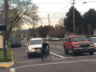
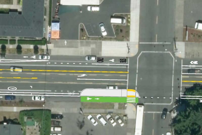
PBOT plans call for a transit median island in this location with the bikeway running (curbside) behind it.
(Photo: J. Maus/BikePortland)
The redesign of North Rosa Parks Way now includes a bike-only signal, wider bikeways (and narrower lanes for driving), a safer crossing, and a floating transit island. These changes (and a few other tweaks) have been made in the month since the Portland Bureau of Transportation first launched the project back in February.
This key neighborhood collector street will see major striping changes from North Willamette to Martin Luther King Jr. Blvd. The biggest change is a parking-protected bikeway (almost) the entire length of the project — and a buffer stripe with intermittent plastic delineator wands for added protection. Instead of on-street parking, PBOT will use the curb lane for a bike-only lane. In the process, PBOT will significantly decrease the amount of parking overall.
Going from west (Willamette Blvd) to east (Martin Luther King Jr. Blvd), here’s how the project has changed in the past month…
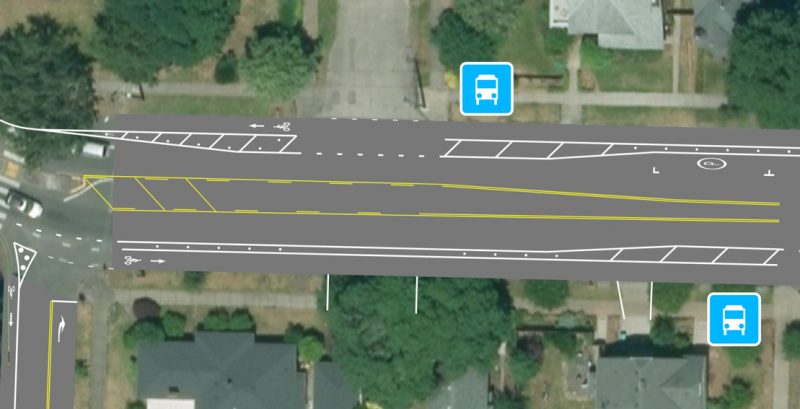
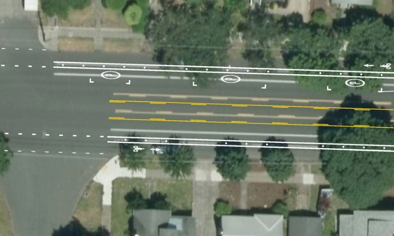
To slow speeds and improve visibility between Willamette and Curtis, PBOT will further narrow the standard lane, widen the bike lane at intersections and remove a parking spot that was shown in their original striping plan:
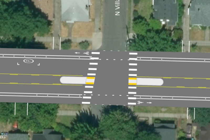
Between Curtis and Greeley, the big addition since last month is a new crossing at Villard that will come with two median islands and zebra-striped crosswalks. They’ve also added an additional stripe in the westbound lane at Atlantic that will further narrow the standard lane and help slow people down.
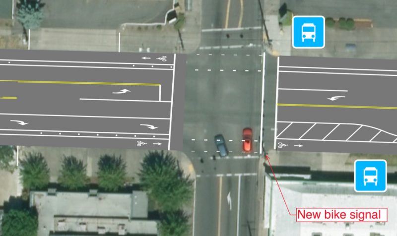
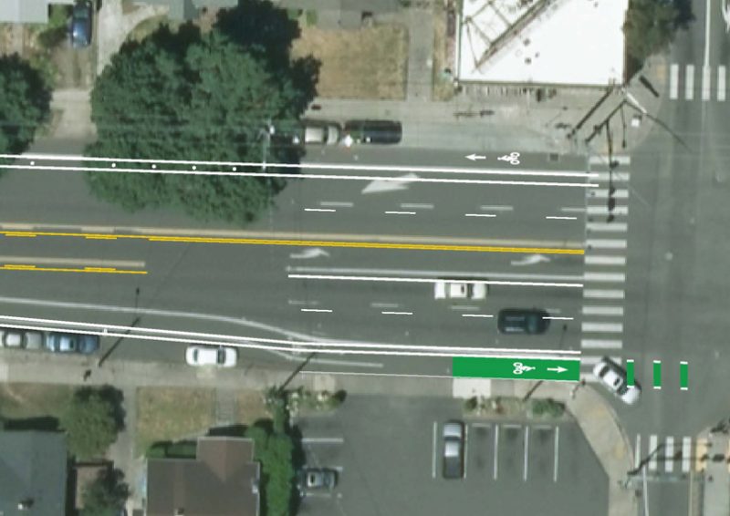
One of the biggest updates is a new bike-only signal at eastbound Greeley. This is being done to end the threat of right-hooks at a very high-volume right-turn only lane (Greeley is a major connector to I-5).
There’s not much change (beyond the parking-protected bikeway) from Greeley to Delaware; and I think that’s where they left off last month. Now the’ve released the striping plan all the way east to MLK.
Besides the bike-lane for parking-lane swap, the new striping from Delaware to Denver largely follows the existing striping. Note that in this five block section, PBOT will no longer allow on-street parking on the south side of the street. And on the north side of the street, the space where parking is still allowed will have been significantly reduced.
Same goes on the section from Denver to Interstate. At Interstate, Rosa Parks will remain at five standard lanes — four for through traffic and a left turn lane. This is a wide profile for a neighborhood street and it’s relatively stressful to bike here. This project will add green coloring to the bike lane (eastbound only as shown), a buffer stripe, and a few intermittent plastic wands. Without more substantial physical separation and/or without reducing capacity for auto users, this intersection is likely to remain dangerous and high-stress for bike users.
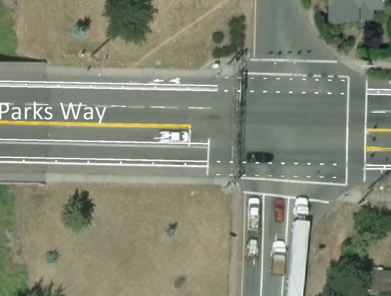
As we head east from Interstate toward I-5, the lane profiles stay similar to what we have today (remember that the Oregon Department of Transportation controls the lane designs approaching and crossing their freeways) with the addition of a buffer stripe and plastic wands to protect the bikeway. That should help the cycling environment, but it’s impact will be limited as long as driving is the dominant activity — and as long as PBOT isn’t able to redesign ODOT’s on-ramps and off-ramps. With their obscenely wide turning radii, the type of driving these on-ramps encourage has a vast negative impact on our community.
East of I-5, the removal of nearly all on-street parking between Michigan and Albina (Peninsula Park) will improve visibility while trying to cross Rosa Parks. However, without the presence of cars, I wonder if this project will result in safer and slower driving behaviors.
At Albina, PBOT is proposing a floating transit island with a green-colored bikeway that will run behind it. This would be an excellent improvement that will make that corner much better.
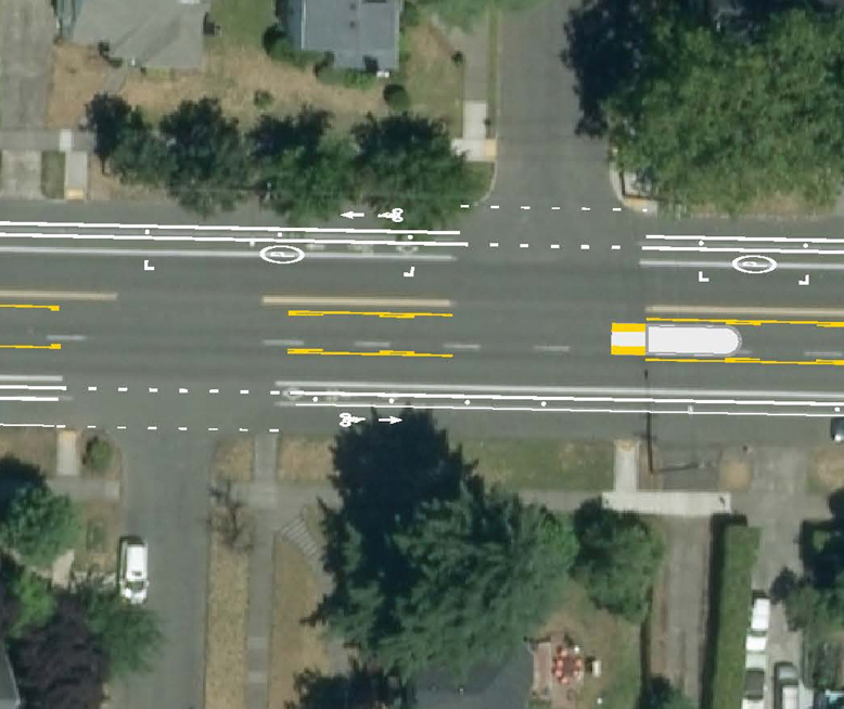
From Albina heading east, the bikeway continues to have a buffer and plastic wands. At the off-set intersection of Rodney (a popular north-south route), the plans call for a median island.
The last notable feature of the current plan is a green bike box at the southwest corner of Rosa Parks and MLK. We’ve heard from members of the Piedmont Neighborhood Association that PBOT plans to remove an existing curb extension at this corner. They are very concerned because a 70-family affordable housing development is coming to that corner and they feel like subtracting sidewalk space is a bad idea. We’ve asked PBOT about this but haven’t heard back yet.
To see all the updated design drawings and more about this project, visit PBOT’s website.
— Jonathan Maus: (503) 706-8804, @jonathan_maus on Twitter and jonathan@bikeportland.org
Never miss a story. Sign-up for the daily BP Headlines email.
BikePortland needs your support.
The post PBOT shares updated plans for North Rosa Parks way protected bike lanes appeared first on BikePortland.org.
from Latest headlines from BikePortland https://ift.tt/2pNNnuL


No comments:
Post a Comment