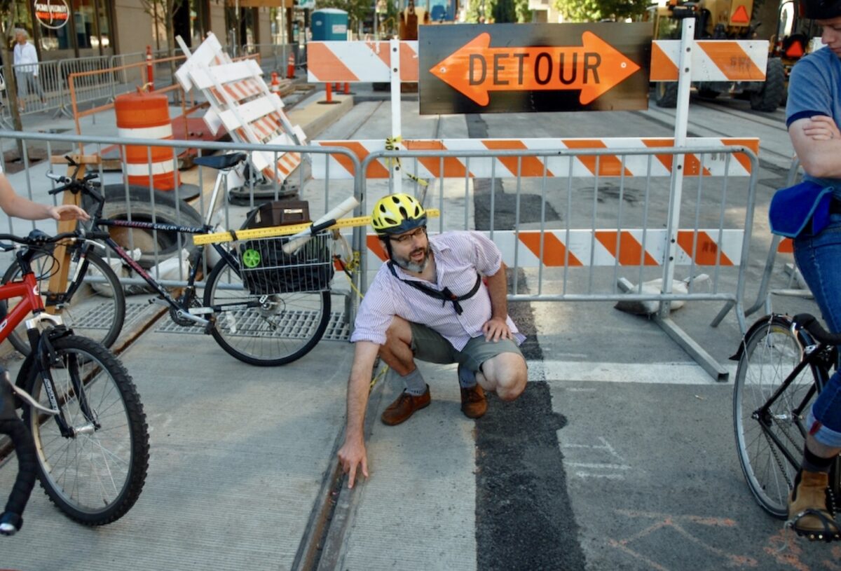
Portland transportation activist Ted Buehler uses his trusty measuring devices (in his bike basket) to uncover the dangers of rail tracks.
(Photo: Jonathan Maus/BikePortland)
“Who’s running Portland right now? You. Pick a problem that really matters to you. Seek organizations addressing it and give them anything you’ve got: time, money, intellect, energy, even tweets. But don’t sit this out. You must engage.”
That’s what Portland activist and former city council candidate Sarah Iannarone posted Wednesday in response to a Willamette Week cover story on Mayor Ted Wheeler’s first two years in office.
How can you “engage” in transportation advocacy? You’re in the right place, since one of our missions here at BikePortland is to get you inspired and informed enough to have a valuable role in local policy and project decisions. But you need tools. Our activism editors Catie Gould and Emily Guise of BikeLoudPDX have put together a list tools they use to sharpen their activism skills.
Take it away Catie and Emily….
For every person who considers themselves a transportation advocate, there are ten more who are interested in learning more but don’t know where to start. Below you’ll find some of the best tips and resources we’ve come across or learned in our advocacy work:
Research
Do you live on a high crash corridor? How many people have been injured at a particular intersection? The City of Portland’s Vision Zero Crash Map is the first place I look to. Clicking incidents on the map, I can find the date and location an injury or fatality occurred, which helps me find related news reports on Google. BikePortland also maintains an updated fatality tracker with links to official Portland Police Bureau statements. The news doesn’t cover all of these incidents, and many people in your neighborhood might not know the extent of the injuries and/or deaths happening in their own community. Talking about it with your neighbors can help build momentum for change. Major road changes need strong community support.
Know what’s coming
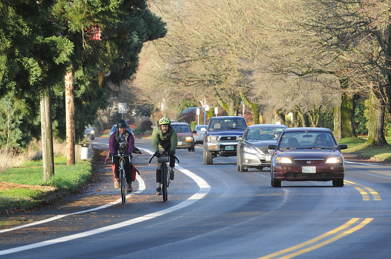
North Willamette Blvd was restriped as part of a paving project because activists spoke up.
(Photo: Jonathan Maus/BikePortland)
When streets are repaved, the lines will need to be redrawn anyway, so it could be an opportunity to implement better facilities. Sometimes just knowing what’s coming (or what’s been proposed in the past), is half the battle.
For example, one year ago, advocates and neighbors on Willamette Blvd saw the street slated for a repaving project and seized the opportunity to push for a restripe of the street that added safer and wider bike lanes. This was a cost-effective upgrade to the street, which had identified the need for better bike facilities in 2011.
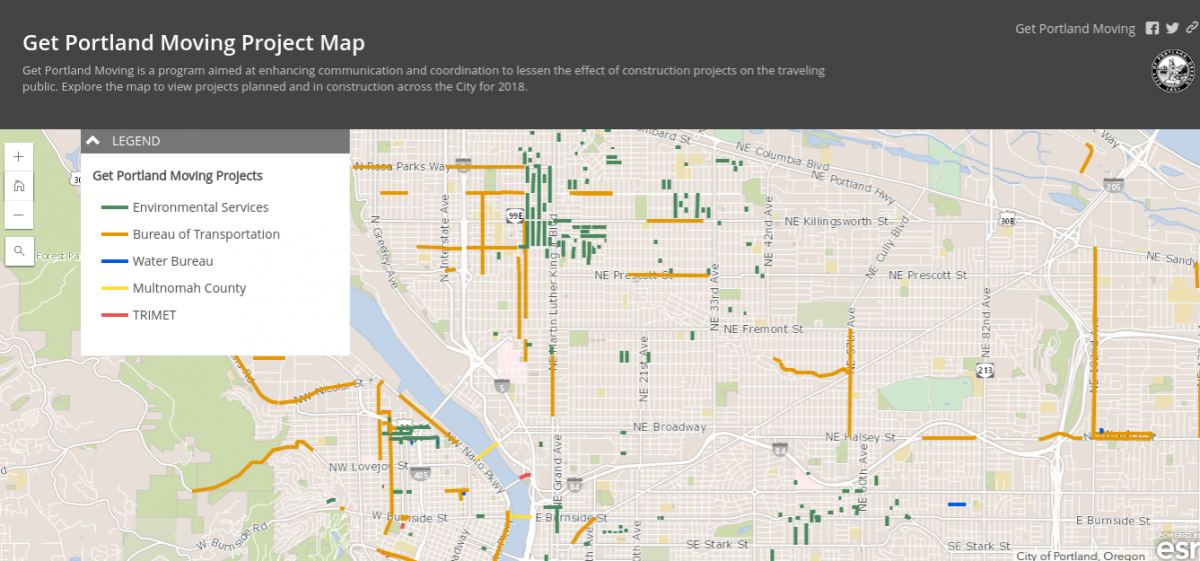
As far as resources to find where the restriping opportunities are in your neighborhood, unfortunately there’s no single website where you can find all the scheduled projects. However, there are two maps that we find helpful. The City of Portland’s Get Portland Moving map shows upcoming repaving projects. And their Fixing our Streets map includes (already funded) repaving projects, crossing improvements, and road repairs.
PBOT’s Projects in the Pipeline website is another good resource. Keep in mind that it’s not an exhaustive list, and most of the projects listed there are already baked and might not have the great potential for change. To see projects previously vetted and prioritized by PBOT, we like to check the 2030 Bicycle Plan and the Transportation System Plan. The TSP is also where we find road classifications, which often dictate what type of bikeway is possible on a given type of street.
Manuals, standards, and guides
Transportation standards are important to know if you want to argue with a city engineer that, actually, a four-foot bike lane is not standards-compliant and it should be wider. It’s much more likely transportation officials will take your proposal seriously if it can be backed up with industry standards in the same manuals they lean on to make decisions.
The biggest (by heft and importance) guide is the Manual on Uniform Traffic Control Devices (MUTCD) from the Federal Highway Administration (FHWA). You can download this behemoth as a PDF here. This is the main standards guide for the vast majority of the country and although it doesn’t have much to say about active transportation, and it’s often mocked by more progressive urbanists as a relic of a bygone era, it’s still a required resource.
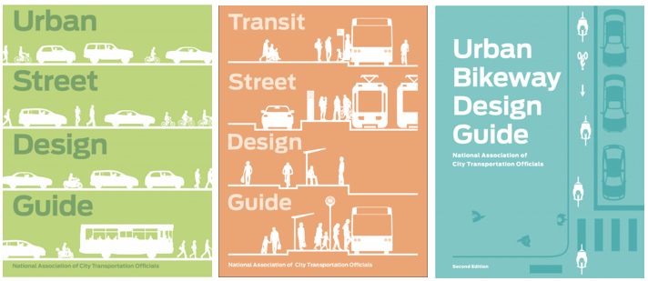
My personal favorites are the guides published by the National Association of City Transportation Officials (NACTO) (pictured above). With their gorgeous graphic design and focus on active transportation and transit, these are coffee table books for transportation nerds that are also extremely informative and useful. Pro tip: sign up for the publisher’s email list to be notified of sales (I was able to get 50% off!). The Multnomah County Library also has copies available to check out.
For a guide with a less official status, the free Tactical Urbanism Guide to Materials and Design is aimed at those looking for ideas to temporarily redesign streets, like what Better Block PDX did on 3rd Ave and Better Naito. This is a very handy guide for putting in temporary designs to test infrastructure ideas and demonstrate that they’re not so scary, after all.
One last guidebook worth knowing about is PBOT’s new Protected Bicycle Lane Design Guide. Jonathan wrote about the draft version when it came out back in June. Unfortunately it appears PBOT has taken it off the web. Perhaps they’re doing some major re-writes? Right now the best version we can find is via a slide presentation about it created by Portland’s Bicycle Program Manager Roger Geller.
Know your measurements

A measurement wheel and spray chalk illustrate how a bike lane could be added to the street.
(Photo: Ted Buehler 2017)
How wide a street is can provide opportunities for reconfigurations to make travel more efficient and safe. You can generally get the cross section measurement from PBOT, especially if there is an active project going on. For example, the 122nd Ave Safety Project, which recently had an open house presenting new road configuration concepts, has an Existing Conditions Report with the dimensions for the different cross-sections along the corridor.
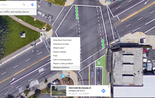
If you want to measure it yourself there are a couple decent methods. You can get a rough estimate of road widths in Google Maps using the measure function. Simply right-click anywhere on the map and select “Measure Distance”. Then make your next click the end of your measurement. You can even tweak the line to make it curve with the street to get a more accurate measurement.
Another handy tool is a measuring wheel. It records the distance traveled as you walk across the street and can be purchased for $30 or less.
Carry a tape measure with you! You never know when you’ll be riding around and encounter a bike lane or turn that feels too narrow or you are in love with a lane that is comfortable for group riding. “How wide is this anyways?” Occasionally stopping to measure things will help you connect your comfort level with dimensions. To me, reading a dimension in a report doesn’t mean much until I can relate it with a similar sized road that I am familiar with. Additionally, there are still many bike lanes around the city that were designed to older standards and are narrower than what we would build today.
Communicate your ideas
What’s your vision for a street in your neighborhood? Here’s how even terrible artists (like me) can make compelling visuals.
Streetmix is a free to use online tool that allows you to build your own streets. Pick your lane types and slide them across the screen to change the order. This artwork will look familiar because professional planners use it too. Images can be downloaded or linked-to via a sharable URL.
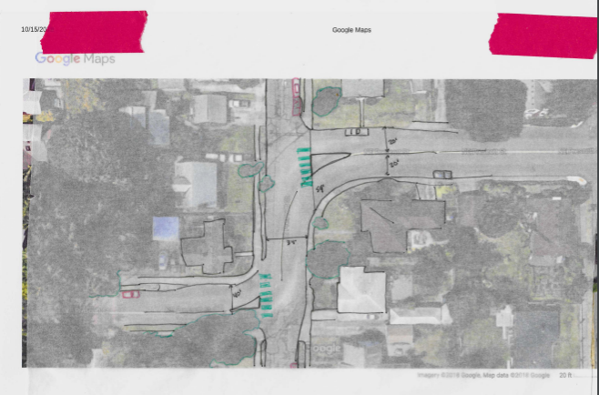
For a top-down view, my favorite way to visualize an idea is to print out a image from Google maps, then cover it with tracing paper. Trace over the major lines, and then fill in a new design. You can find drawing supplies and tracing paper for about $10 a roll at craft stores. It scans well too, so you can send your sketches over email and post them online.
Flagging issues
If you want to get a specific issue or intersection on the City’s radar and into their fully-staffed TrackIt system, there are a few ways to submit a complaint. You can go through their webform, email safe@portlandoregon.gov, or use one of the handy phone numbers below. Program these into your phone right now! (Just be careful when making calls in public so you don’t end up being mocked in a viral video.)
503-823-SAFE (7233) for general transportation safety concerns
503-823-1700 for 24-hour immediate maintenance issues like malfunctioning traffic signals, overgrown vegetation on sidewalks, street sweeping, etc.
503-865-LAMP (5267) for streetlight outages
*See PBOT’s contact page for more helpful numbers and email addresses
Posting an issue to social media by tagging @PBOTinfo“>@PBOTinfo on Twitter is also a good way to connect with the City. Having a good photo is key!
PDX Reporter is another way to connect with PBOT about your issues and concerns. Once an easy-to-use app, the City has recently downgraded it to a website. It’s not as good of a resource as it once was, but it’s still an effective way to report potholes and other issues.
We hope you find these resources helpful. Have others to share? Please let us know in the comments.
— Catie Gould, @Citizen_Cate and Emily Guise @eguise
Get inspired with more Adventures in Activism here.
Never miss a story. Sign-up for the daily BP Headlines email.
BikePortland needs your support.
The post Adventures in Activism: Tools of the trade appeared first on BikePortland.org.
from Latest headlines from BikePortland https://ift.tt/2L3if4W



No comments:
Post a Comment